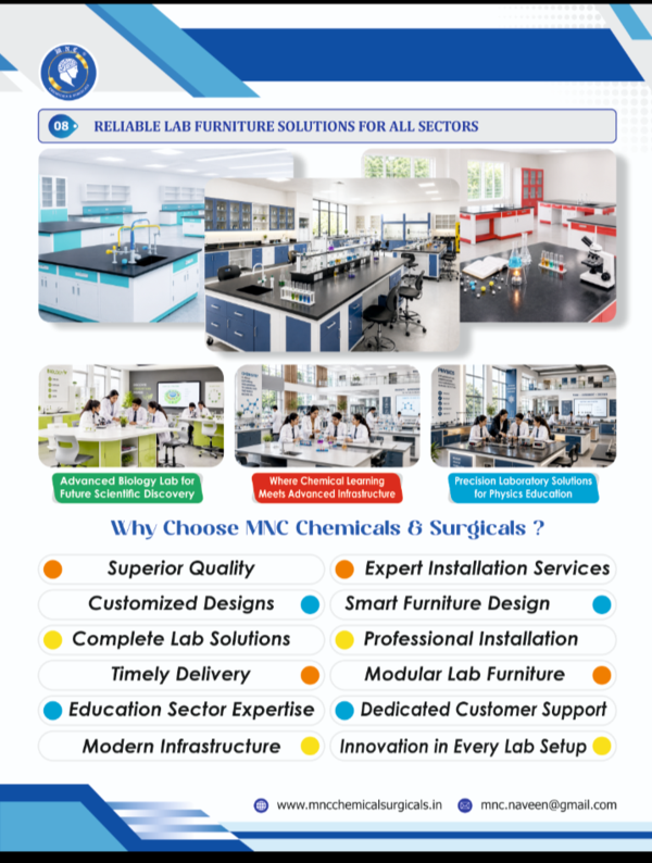
Description
A Jammu & Kashmir Political Map in 70×100 cm format is available as a large-format laminated wall chart, designed to meet educational, reference, and cataloging requirements. This map reflects the updated administrative bifurcation that separated Jammu & Kashmir and Ladakh into Union Territories.
Specifications and Features
Dimensions: 70 × 100 cm (portrait or landscape layout).
Material: High-quality map litho or photo paper, often laminated for classroom and handling durability.
Details: Includes all current administrative districts, major cities (such as Srinagar, Jammu, Leh), new boundaries dividing Jammu & Kashmir and Ladakh, road and railway routes, and color-coded divisions for clear understanding.
Language: Maps are available in English and Hindi editions to suit classroom diversity.
Certification: Most maps used for educational/reference are certified or updated per the Survey of India, with bifurcation as per the Jammu & Kashmir Reorganization Act, 2019.
Map Content Coverage
Shows both Union Territories—Jammu & Kashmir and Ladakh—with clear distinction.
District names and boundaries in both UTs.
Locations of capitals: Srinagar, Jammu, Leh.
All major infrastructure and regional features.
Availability and Vendors
Maps can be sourced from Indian Book Depot, Vidya Chitr Prakashan, and official map retailers. Flipkart and other educational supply sites regularly stock such wall charts suitable for classroom, seminar, and catalog use.
Digital preview and customized sizes offered for catalog or web requirements.
Purchasability and Use
Priced typically from ₹120–₹275 per chart, depending on finish and vendor.
Suitable for geography education, competitive exam prep, and catalog documentation.
For royalty-free digital images to be converted to 800×800 px JPEG (under 2MB) for your catalog, you can use updated maps from government sources, educational vendors, or stock image providers.