
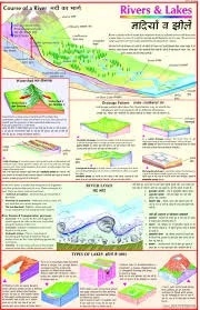
Course of a River (50x70cm)
Description
The “Course of a River (50x70cm)” chart is a mid-sized educational poster showing the journey and transformation of a river from its source to its mouth. It visually demonstrates the three classic stages of a river—upper, middle, and lower course—and the major landforms and processes that characterize each part.
Key Features
The chart is organized into the three stages of a river:
Upper Course (near the source): Features steep gradients, fast flow, vertical erosion, V-shaped valleys, interlocking spurs, gorges, rapids, and waterfalls.
Middle Course: The river becomes wider and deeper, with a gentler gradient. Notable features are meanders, wide U-shaped valleys, river cliffs (erosion on outer bends), slip-off slopes (deposition on inner bends), and oxbow lakes forming as meanders become exaggerated.
Lower Course (approaching the mouth): The river reaches its widest and slowest part, with gentle slopes, significant lateral erosion and deposition, and the formation of floodplains, levees, deltas, and estuaries.
Clear cross-sectional and plan diagrams are used to show channel shape, valley profile, and development of features like meanders and oxbow lakes.
Includes labeled illustrations and concise explanations for each feature, often enhanced with visual examples or photographs.
Laminated finish makes it suitable for group teaching, regular classroom display, or lab-based geography lessons.
Specifications
| Model No. | N-C043 |
|---|


